


Visita 360

Ruta Allamonte-Bollullos

This low-intensity route allows you to take a twelve-kilometre walk while enjoying the typical countryside landscape.

From Almonte, take the A-484 towards Rociana and follow the path parallel to the road. Take great care when you need to leave it to join the road, such as at the Almonte exit junction.

Continue left along the Monte Alto road after passing a paved road for about 500 metres.

However, if you wish to visit Rociana del Condado, which we recommend due to the beauty of its historic centre, take the two-kilometre detour that starts at point 5.6 on the road. Once in Rociana, you can return to the route by retracing your steps to the aforementioned Monte Alto road.

Heading towards Bollullos, the vineyards, which change so much throughout the year, become omnipresent. Crossing the different agricultural areas and fields, we not only get some exercise, but also gain a better understanding of the socio-economic structure of the county, which is so dependent on wine, cereals, olives and fruit trees.
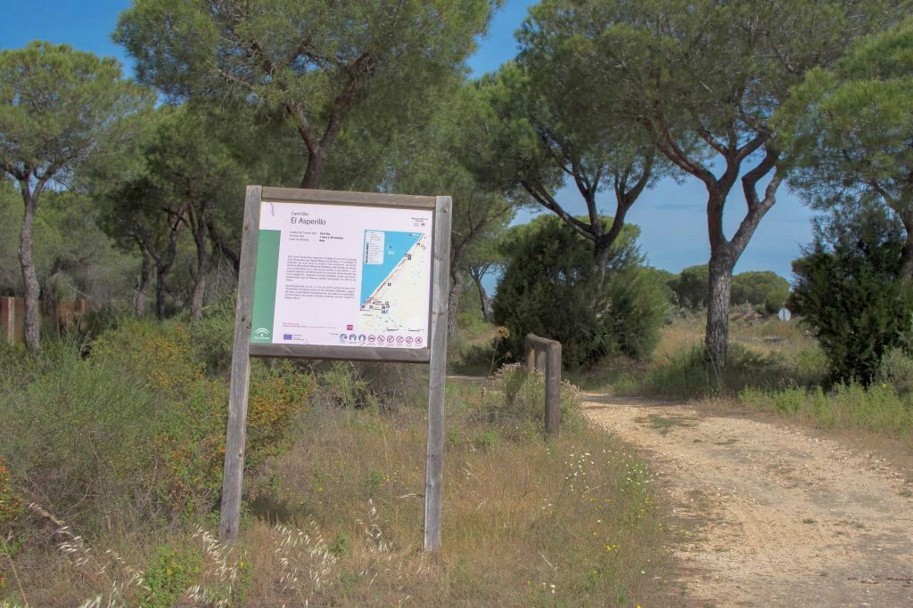
Carril cicloturista del Asperillo

This cycle route runs along one of the most outstanding landscapes in the Doñana Natural Park: the El Asperillo cliff, from which it takes its name. This cliff, also declared a Natural Monument of Andalusia, is formed by sands that were once shifting dunes and which, due to a subsequent elevation of the terrain together with the action exerted by vegetation, gave rise to the current coastal cliff of stabilised sands that exceed 100 metres in height at various points.

Approximately 4 and 11 kilometres from the starting point of this cycle route, you will find the start of the Laguna del Jaral and Cuesta Maneli trails respectively, which offer splendid opportunities to enjoy this magnificent natural vantage point on foot.

Ruta Manzanilla – Paterna del Campo

The route between Villalba del Alcor and Paterna del Campo covers approximately 11 kilometers, ideal for those seeking a hiking experience that combines nature and historical heritage.

The route begins in Villalba del Alcor, taking the Berrocal road. After traveling about 2.5 km, you leave this road to join the Seville-Huelva road. Along the route, you will cross footpaths and rural roads, allowing you to observe farmland that has maintained its essence over the centuries. Most of the path is downhill, making it easy to reach the Aguilones footpath, which leads directly to Paterna del Campo.

At the beginning and end of the route, we recommend visiting the monuments in both municipalities. In Villalba del Alcor, the church-fortress of San Bartolomé, a building of Almohad origin declared a Site of Cultural Interest, and the convent of San Juan Bautista, founded in 1618 and known for its architecture and Baroque altarpieces, are particularly noteworthy. In Paterna del Campo, you can see the castle of Alpízar, an ancient fortress with an Almohad-style doorway, and the chapel of San Isidro Labrador in the village of Tujena, which dates back to 1955 and is the center of a popular pilgrimage in May.

At the end of the tour, you can enjoy the local cuisine in Paterna del Campo, known for its chickpea stews, traditional sweets, and cold cuts.

Ruta Villalba-Manzanilla

The Villalba del Alcor – Manzanilla Hiking Trail is a route of approximately 6 kilometers that connects both towns through a landscape typical of the Huelva County. The route begins by taking the Almonte road for the first kilometer and a half, then turning left towards Manzanilla.

Along the way, hikers pass through fields of grain, vines, and olive trees, which offer a palette of colors and textures that vary depending on the season. The environment combines fertile crop areas with sandier areas, providing an enriching visual and sensory experience.

This route is suitable for people of average physical fitness and can be done on foot or by bicycle. At the end of the tour, visitors have the opportunity to explore the local wineries in Manzanilla, known for their wine-making tradition.

Ruta “Manzanilla-Chucena”

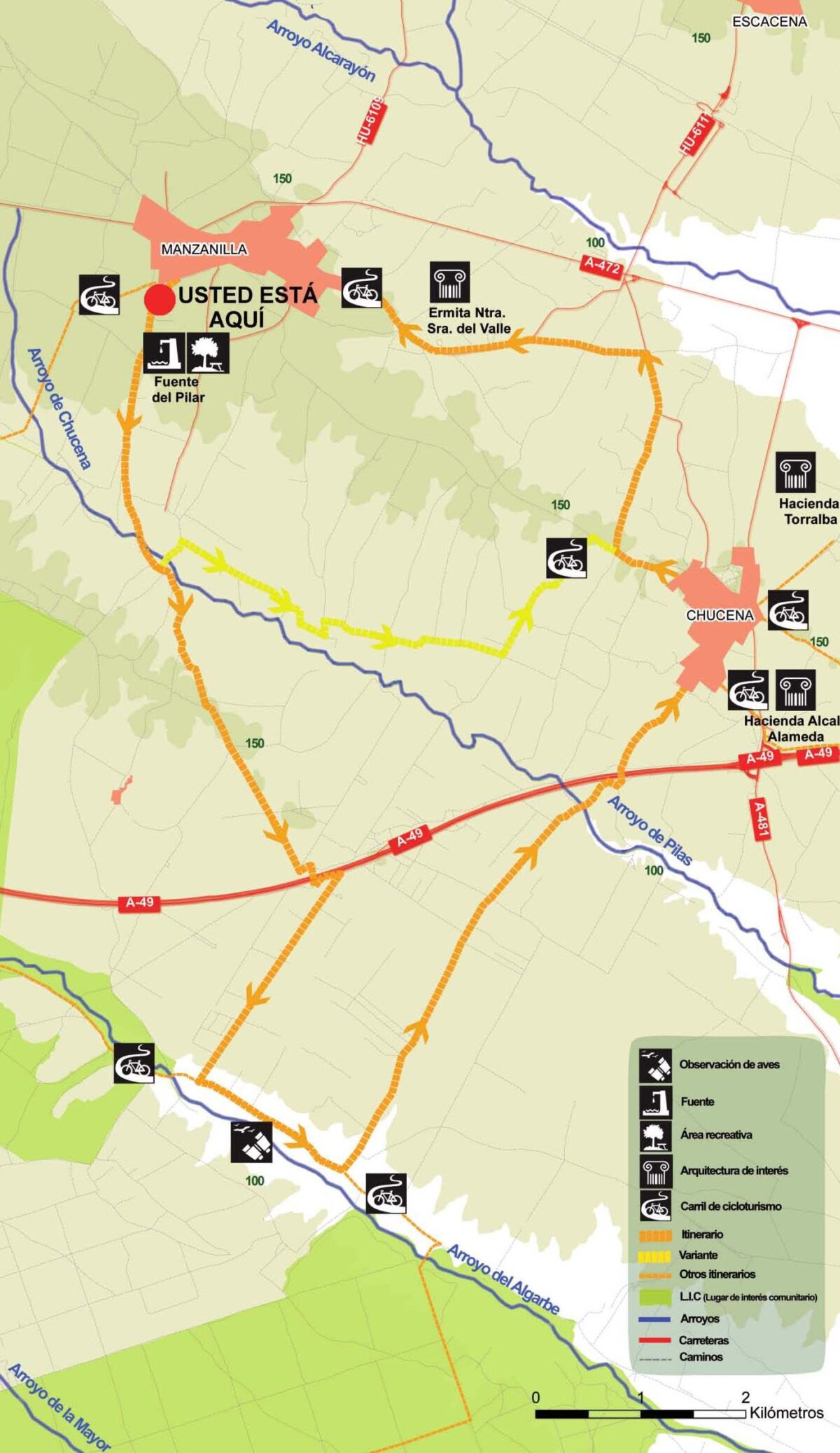
This route runs between two well-known towns in the county: Manzanilla and Chucena. Although it is not difficult, it may require a little effort because it takes longer and therefore requires greater stamina. It is worth it for the beautiful landscape that will accompany you along the way. On one side, there are extensive fields of crops, which offer a variety of colors and textures, and on the other, there is a forest area, which offers a more monotonous landscape, as it is a eucalyptus grove. Visually, it contrasts with the previous section, as in this case, given the flatness of the terrain and the characteristics of these plantations, there is a total visual closure once inside the eucalyptus forest.

Leaving Manzanilla, there are mainly Mediterranean crops, olive trees, and vines, reflecting the olive and wine-growing tradition of the municipalities of Manzanilla and Chucena.

After 2.5 km, you will have two options: continue on the main route or take the alternative route (short route). If you choose the former, you will have to cross the eucalyptus forest to reach the border between the municipalities of Manzanilla and Villalba del Alcor. The path becomes sandier and therefore more difficult. You will have to continue across the bridge over the A-49 and follow the path that leads to the so-called “Camino de la Palma” or “Vereda de Hinojos.”

Once there, you will be able to see the riverside vegetation that accompanies the Arroyo del Algarbe stream on your right, with holm oaks, poplars, and aspens, along with an important birdlife that is difficult to observe frequently: collared flycatchers, blackcaps, bonelli’s warblers, and tree sparrows.

Continue along the Camino de Purchena or Camino de Almonte, which leads directly to the town of Chucena. On the way to Manzanilla, you can visit the Ermita de Nuestra Señora del Valle, the patron saint of the town, where a pilgrimage is held in June.

Ruta “Manzanilla-Chucena”

This route runs between two well-known villages in the county: Manzanilla and Chucena. Although it is not difficult, it may require a little effort because it takes longer and therefore requires greater stamina. It is well worth it for the beautiful scenery that accompanies you along the way. On one side, there are extensive fields of crops, which offer a variety of colours and textures, and on the other, there is a forest area, which offers a more monotonous landscape, as it is a eucalyptus grove. Visually, it contrasts with the previous section, as in this case, given the flatness of the terrain and the characteristics of these plantations, there is a total visual closure once inside the eucalyptus forest.

Leaving Manzanilla, there are mainly Mediterranean crops, olive trees and vines, reflecting the olive and wine-growing tradition of the municipalities of Manzanilla and Chucena.

After 2.5 km, you will have two options: continue on the main route or take the alternative route (short route). If you choose the former, you will have to cross the eucalyptus forest to reach the border between the municipalities of Manzanilla and Villalba del Alcor. The path becomes sandier and therefore more difficult. You will have to continue across the bridge over the A-49 and follow the path that leads to the so-called ‘Camino de la Palma’ or ‘Vereda de Hinojos’.

Once there, you will be able to see the riverside vegetation that accompanies the Arroyo del Algarbe stream on your right, with holm oaks, poplars, aspens… Along with an important associated birdlife, which is difficult to observe frequently: collared flycatchers, blackcaps, bonelli’s warblers, tree sparrows.

Continue along the Camino de Purchena or Camino de Almonte, which leads directly to the town of Chucena. On the way to Manzanilla, you can visit the Hermitage of Nuestra Señora del Valle, patron saint of the town, where a pilgrimage is held in June.

Ruta Hinojos-Villamanrique

This route, which is 10.3 km long and easy, runs between one of the best-known villages in the county and another in Seville: Hinojos and Villamanrique de la Condesa.

It starts from the village of Hinojos towards the Camino de las Paradejas. After just over two kilometres, turn left onto the road parallel to the A-481. Up to this point, you will see a landscape dominated by forests and crops.

Once you have left Hinojos, you will find the Doñana Natural Area on your right. Pine forests, mastic trees, cork oaks and rockroses provide shelter and a home for the area’s abundant wildlife, especially a variety of bird species. The vegetation changes as you pass the Arroyo del Gato stream, becoming typical riverside vegetation. Poplars and elms, above all, where nightingales and blackcaps perch.

Further on, the olive groves announce the proximity of Villamanrique, where the route ends, specifically at the Dehesa Boyal Visitor Centre.

Ruta circular Hinojos-Almonte-Bollullos

Start by crossing the road and turning left onto the path that will take you to the public forest called “Los Propios,” where stone pines abound, surrounded by scrubland.

Continue towards the Cumbre Hermosa forest house, within the well-maintained forests of Almonte.

Continuing along the Juncalejo path, you will see how the landscape changes, giving way to crops such as olive trees and cereals. This landscape pattern continues until you reach Almonte, but after passing this municipality, vineyards take center stage.

Parallel to the Cárcava stream, you will reach Bollullos, but before leaving this municipality, you can stop at the beautiful Dehesa de San Sebastián.

To complete this circular route to Hinojos, eucalyptus trees will gradually take over the landscape and, as is usual in areas where this tree is abundant, you will have to contend with generous sandbanks. The effort will be worth it when you see the beauty of the Dehesa Garruchena, a hill covered with cork oaks and pastures offering unique views.

You will return to Los Propios, where the route began and from where you can access the El Algarbo stream. From there, you will return to Cubre Hermosa and then back to Hinojos, with no chance of getting lost.

Ruta Prado de Luna

The Prado de Luna Route is a linear itinerary of approximately 12.1 km with medium difficulty, ideal for hikers who want to enjoy a walk through the natural surroundings of Escacena del Campo. The route runs along agricultural paths and rural tracks, crossing fields of wheat, chickpeas and sunflowers.

The trail begins near the town centre of Escacena and enters a landscape typical of the Huelva countryside, with flat terrain and gentle slopes accumulating a total elevation gain of about 114 metres. Along the way, walkers can enjoy a peaceful, open environment, ideal for observing the local flora and fauna.

The path is accessible and passable, although suitable footwear for hiking is recommended due to the nature of the terrain. The route allows you to learn about the relationship between the natural environment and the agricultural traditions of the area, offering a leisurely experience close to the countryside.

Ruta Pata del Caballo

The route through the Pata del Caballo forest area is a linear itinerary of approximately 23 km of medium-high difficulty. It is suitable for both hikers and cyclists, although some sections require caution.

The route begins in the countryside of Tejada, in the town of Paterna del Campo, and enters the Pata del Caballo forest, an estate of more than 7,000 hectares located in the municipality of Escacena del Campo. The route follows agricultural roads and forest tracks, crossing olive groves and areas of Mediterranean vegetation, such as rockroses and holm oaks.

From the fifth kilometre onwards, the path becomes stony and increasingly difficult until it reaches Casa del Carnero. This is one of the highlights of the route, offering panoramic views of the Condado countryside. A little further along the track, you can take the short route to the Castillejos reservoirs and from there join the main route at the Gallinas crossroads. If you continue along the main route, you will climb up to Torre del Cejo, one of the highest points in the Condado, which offers one of the most impressive views of the surrounding area.

A little further on is the turn-off for Barranco de los Laureles, a grove classified as unique for its ecological value, and a little later the second turn-off: the Las Contiendas forest house, recently restored and used for