Visita 360

Sendero Paseo Marismeño

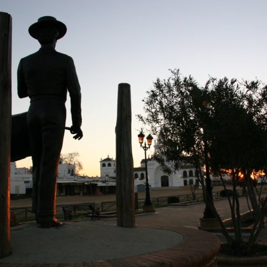
The surroundings of the walk, in the heart of the village of El Rocío, are spectacular, as it is located next to the marshes and you can see horses and foals all year round, as well as spoonbills, flamingos, glossy ibises and herons. It is a must for birdwatchers and nature lovers, and for watching a wonderful sunset.

At the marsh viewpoint, there is a tribute to the figure of the drummer, an indispensable character in the Romería del Rocío pilgrimage, with a life-size representation of him playing the flute and drum, dressed in the classic rociero costume and wide-brimmed hat. The sculpture is by José Manuel Díaz Cerpa.

This walkway connects to the Votive Chapel and the Sanctuary via a footbridge, so that it can be accessed by people with reduced mobility or in wheelchairs.

Sendero Lagunas del Huerto y las Pajas

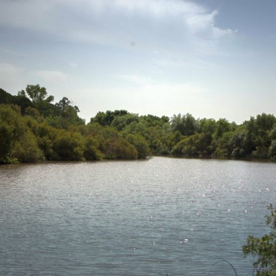
This 2.3 km trail, which is easy to walk, starts next to the last observatory on the left side of the Acebuche Lagoon trail. The Huerto and Pajas lagoons, together with other small temporary lagoons, form a complex that also includes the Acebuche lagoon and originates from the emergence of groundwater, as the water table is practically at the surface in this area.

The entire trail runs through the reserves, thick scrubland dotted with small groves of stone pine and scattered junipers, which provide an ideal habitat for small and large mammals. Although they are quite elusive, it is not difficult to find traces of deer, wild boar, mongoose, fox, badger… or perhaps even spot them in the thick scrub. The small pine forests also provide ideal nesting areas for various species such as red kites, booted eagles, common kestrels and azure-winged magpies.

The flora, which is greatly influenced by the level of flooding and therefore has a marked seasonal character, includes species such as bulrush, bayunco, cattail, buttercup, grass or millet, and the so-called marsiega. In the most exposed areas, other Mediterranean species appear, such as lavender, rosemary, and almoradú.

Sendero Laguna Ribetehilo

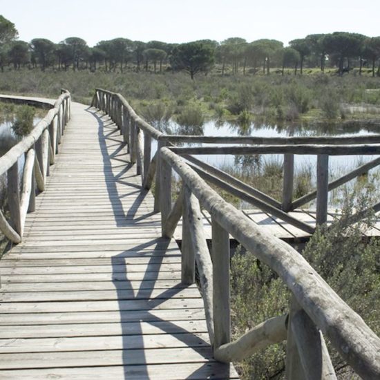
Ribetehilo (a row of riverbanks) marks the meeting point of two different geological substrates. This 2.4 km trail, which is easy to walk, runs along a wooden walkway and follows the boundary that was once a riverbed, barely recognisable today, where water finally came to the surface. This group of lagoons, accompanied by a sea of stone pines and white mountains, contrasts with the predominantly sandy landscape of the surrounding area. Cork oaks, strawberry trees and broom are replacing the eucalyptus trees with which the area was repopulated years ago.

Along this route there are explanatory signs on different topics of interest: the reforestation of eucalyptus and pine trees; peat and carnivorous plants; the strawberry tree and its fruits; the palm tree and its uses; the geological substrates and the colour of the sand; and the restoration of the landscape and its future vision, which can be seen little by little along much of the route. The linear trail runs directly over the sand until it reaches a footbridge that crosses the lagoon and allows you to enjoy one of these wetlands from within.

The comfortable wooden footbridge allows you to explore one of these lagoons, the Galápago, and the vegetation that today aims to restore the appearance of these lands as our ancestors knew them.

Sendero Laguna del Jaral

The Jaral lagoon is a large clearing in a pine forest. This trail requires considerable effort, as it runs through sandy terrain with uneven ground. However, the appeal of the contrasting landscape more than makes up for it. Starting from the road and the nearby lagoon area, we walk through pine forests planted in the mid-20th century to prevent the advance of the Asperillo dune, an impressive dune front that rises like a cliff overlooking the Atlantic Ocean.

The route allows you to enjoy the Asperillo dune and its cliff, declared a Natural Monument of Andalusia for its ecological and geological value.

Sendero Laguna del Acebuche

This 5.4 km route, which is easy to walk, runs parallel to the lagoon from which it takes its name and leads to various observatories from which you can discover the aquatic fauna that frequents these wetlands. Different species can be seen depending on the time of year. One of the most unusual species, which can be seen throughout the year, is the purple swamphen, a bird with intense blue plumage and long red legs that nests in wild olive trees.

In spring, it is easy to spot other resident or summer birds that also breed in the lagoon, perhaps with their chicks: mallards, common pochards, little grebes, great crested grebes and black-necked grebes, among others. During the autumn and winter months, it is possible to spot wintering species that arrive from the north in search of milder climates: gadwalls, wigeons, red-crested pochards…

The wildlife that can be seen is in the wild, so you may need to concentrate all your attention to spot it. Discovering the birdlife of the lagoon will require paying attention to the movements of the vegetation, sounds and songs, changes in shapes and colours…

The trail runs along wooden boardwalks, which adapt to the terrain and make the route comfortable and safe. There are no slopes to negotiate, as the entire trail is practically at the same altitude. From the boardwalks, you can access some cabins, which serve as viewpoints and have observation posts at a lower height.

The trail ends by retracing our steps back to the visitor centre, where the route ends. At the start of the route, before entering the El Acebuche Visitor Centre, and accessible via a small adapted ramp that overcomes a 5 cm difference in level, there are adapted public toilets.

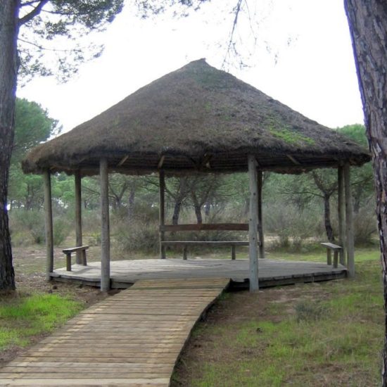
Along the trail, there are various elements that refer to traditional uses, some of which have now disappeared, that the inhabitants of the area made of the resources offered by the territory. Also pay attention to the construction type of the observatories; in the past, huts similar to these, built with palustre vegetation, were the usual dwellings of many workers and their families.

Sendero Dunar

This enclave is the most important system of living or mobile dunes remaining on the Iberian Peninsula and offers one of the most spectacular landscapes in Doñana National Park.

The dune system stretches for 25 km parallel to the coastline and is between 500 and 5,000 metres wide, reaching a height of 40 metres at Cerro de los Ánsares, the most emblematic shifting dune in the National Park.

Along the route there are different subsystems: from the embryonic dune areas at the edge of the beach to the first corral where large trees already appear. The walk ends at the beach, flanked by reddish cliffs at the foot of which the fine white sands stretch out.

Sendero Cuesta Maneli

The Médano del Asperillo trail, the highest natural viewpoint in the Doñana area, offers a unique landscape. From its start next to the dunes to its descent towards the sea, it reveals flora and fauna adapted to extreme conditions. Foxes, rabbits and even the elusive Iberian lynx inhabit this ecosystem, which is also rich in invertebrates and reptiles. The influence of the sea is evident on the coast, where plants such as sea lavender and sea lotus resist the ‘spray effect’, the effect of air and salt on them.

Stories of Roman settlements and tuna traps are intertwined with its summer past and its present as a protected area, promoting research and responsible enjoyment of nature.

Sendero Charco del Acebrón

Next to the Acebrón Palace, built in 1961 by Luis Espinosa Fontdevila, begins the 2.1 km low-difficulty footpath that enters the protected area and brings visitors closer to scenes that, year after year and century after century, have distinguished these forests. During spring and summer, the forest is at its most splendid. After flowering, which occurs between December and April, the new leaves form a green canopy that closes off the space, creating a shady environment. Large ash trees flank the entrance, standing on the bank, very close to the water. The ash grove occupies dark soils that are rarely flooded but always remain cool. These large trees, with compound leaves and rough trunks, have been intensively exploited since ancient times.

Next, occupying almost the entire riverbed, is the willow grove. The footbridge allows visitors to see up close willows, locally called Zaos, and dogwoods, a species endemic to western Andalusia representative of Tertiary flora that survives in these cool, humid areas. Along with them, various climbing species: honeysuckle, wild grapevine and sarsaparilla form a compact mass of vegetation where countless small birds hide.

Beyond the riverside forest lies a pine forest of stone pines. This drier, higher terrain was occupied decades ago by eucalyptus plantations. Today, following the removal of exotic species, the native vegetation has been restored. Various woody species such as hawthorn, rosemary, mastic, rockrose, Moorish rockrose, gorse and spurge form the undergrowth of the pine forest and continue to gradually colonise the territory.

The trail enters the riverside forest again to cross the stream. Before leaving this second footbridge, interesting species of ferns such as royal fern and Thelypteris palustris can be seen under the willows. Behind them, the cork oak forest appears. Here the soil is dark and rich and accumulates abundant organic matter. In these more sheltered areas, peat bogs form, valuable and extremely fragile biotopes that are home to very rare plant communities characterised by the presence of ciliate berzo, dwarf gorse and numerous herbaceous species from humid environments. In the last section of the trail, several tributaries of the stream, known locally as algaidas, have a high density of vegetation with species such as sedge, cattail and masiega, among others. Alongside these algaidas are numerous specimens of white poplars that will accompany you until the end of the trail.

Sendero Charco de la Boca

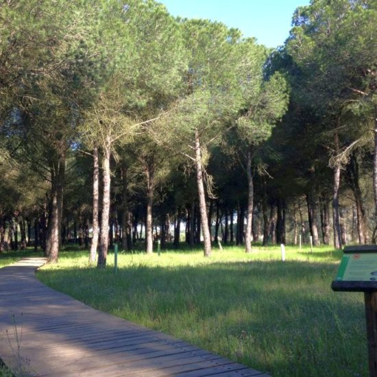
The Charco de la Boca trail, which is easy and 3.8 km long, begins in the front courtyard of the La Rocina visitor centre. It consists of several adjoining paths, allowing you to organise your route according to your interests. The route heads towards the bank of the stream through a pine forest covered with a carpet of grasses. The stone pine is a species whose presence in the area has been documented since the 18th century and today constitutes one of the most distinctive landscapes of Doñana.

The first observatory overlooks the last section of the stream, where the channel becomes wide and shallow. During the seasons when the area remains flooded, countless birds populate these waters. The trail then enters the Algaída del Carrizal, a tributary of the stream that is covered with abundant vegetation. The footbridge winds its way through willows and reeds, offering a privileged view of the flooded areas.

Once you have crossed the stream, the pine forest continues, covering the entire route until you reach the second observatory over the stream. After this, you will see the Algaida del Meloncillo, another stream that carries water to the river. On both banks, the ground is covered with dense ferns, marking the transition to the riverside vegetation that covers the riverbed. Several large cork oaks stand out, located very close to the water next to the willows. At this point, the trail forks, offering the option of continuing along the footbridge or entering the pine forest again.

This second footbridge leads to flat, open terrain covered with white pine, where the pines give way to a canopy of white rockrose accompanied by various aromatic plants such as rosemary, lavender and almoradux. Around the stream, the ground is more humid and rich, and the vegetation diversifies, with the appearance of wild olive, kermes oak, mastic and palm trees.

Following the other branch of the trail, you will re-enter the pine forest and end up once again at Algaída del Carrizal, where reeds dominate the landscape. Climbing species entwine themselves among the reeds, supporting their long, flexible stems as they seek out areas of light; sarsaparilla, honeysuckle, bindweed and blackberries create a dense and intricate tangle.

Leaving the footbridge, the trail runs alongside the stream, offering a panoramic view of the different plant formations that line its banks, from the distant pine forests to the blanket of reeds and cattails that occupy the centre of the stream, passing through cork oaks, ferns and willow groves, in a great diversity of strata, colours and shapes.

Ruta Matalascañas-Sanlúcar de Barrameda

Countless gastronomic offerings, leisure activities, outdoor pursuits, nightlife, and water sports, as well as camel and horse rides through the dunes and along the shore, make Playa de Matalascañas an incomparable setting and a must-see for all audiences. A privileged place where light, nature and climate come together to offer the most beautiful sunsets and the most unique views of Torre La Higuera.

Matalascañas offers visitors a wide variety of tourist accommodation, including holiday apartments, guesthouses and hotels of up to four stars, giving tourists the opportunity to enjoy exclusive experiences, both inland and on the shores of the Atlantic Ocean. It is an ideal destination for singles, couples and families due to its numerous services and options for relaxation, sport and entertainment, as well as for personal and business events. Without a doubt, this extraordinary setting offers visitors excellent facilities and quality service that guarantee a successful stay in Playa de Matalascañas.

A maze of trails and paths wind through an area of dunes and pine trees, where visitors can gaze out over the endless Atlantic Ocean on one side and a vast sea of green pine forests on the other. This is the Dunar Park, a truly delightful place where riding a dromedary across the dunes or horse riding along the shore becomes an unforgettable experience for nature lovers. With the aim of revitalising and restoring the area, the Parque Dunar Association organises hiking and environmental education activities, bringing together ecotourism, sport and leisure in this splendid Doñana Park.

Kilometres of cycle paths run through the Matalascañas residential area, passing through pine trees and scrubland along the Paseo Doñana, parallel to the National Park and connecting Matalascañas with Mazagón. Likewise, walking along the Sendero Dunar trail, visitors will discover the most important system of shifting dunes remaining on the Iberian Peninsula and one of the most spectacular landscapes in Doñana.

Throughout the year, Matalascañas organises popular races and sporting events for lovers of healthy living and outdoor activities. In summer, one of the most attractive and refreshing experiences visitors can enjoy is contemplating the coast of Doñana from the ocean itself and feeling it fully. That is why there are clubs and active tourism companies that offer a wide variety of courses and recreational, sporting and water activities for all audiences. Jet skis, sport fishing, sea routes, surfing, banana boats, sailing, pedal boats… endless possibilities to make summer not only healthy, but also fun and fascinating, all in the exceptional setting of Matalascañas Beach.

Matalascañas can be enjoyed not only in the summer season. The year begins with the Three Kings Parade and the popular Carnival, and summer kicks off with the impressive San Juan Festival. Numerous bars and nightclubs, leisure centres, craft fairs and street theatre enliven the days and nights in this tourist destination, which also caters for children in its recreational activities. Fun and educational workshops on the beach, camel rides, street music, boat trips, stargazing and trampolines with slides and trampolines are all part of the offering, making Playa de Matalascañas an attractive holiday destination.

The existence of optimal facilities, accessibility conditions and the range of services provided to users have earned it recognition as an Inclusive Beach, with an Ecoplaya Flag and the SICTED and Q for Quality tourism quality distinctions. It is equipped with seven lifeguard and surveillance stations along the entire length of the beach. There are also nine self-cleaning toilet facilities distributed along the promenade and in the urbanisation itself, which can be explored by city bus and enjoyed on the tourist train. There is also a taxi service and intercity buses that allow visitors to travel even at night.

Matalascañas offers a diverse cuisine, with healthy and tasty dishes in which the meat, fish and seafood from the Huelva coast are complemented by excellent vegetables from local gardens and washed down with the best wines from the region. Fried fish, Matalascañas clams, Huelva cuttlefish and white prawns, as well as Iberian meats from the mountains, are undoubtedly an attraction for the most discerning palates.

High-quality local products such as honey, olive oil and organic red fruits undoubtedly complement this great gastronomic offering, distributed among the numerous restaurants inland and the 23 beach bars along 4 kilometres of splendid sandy beaches.